Medjil - the Survey Instrumentation Calibration Portal

The Landgate Geodetic team, in collaboration with partners from other jurisdictions, has developed an online Electronic Distance Measurment Instrumentation (EDMI) calibration portal called Medjil. This new platform replaces the legacy Baseline.exe software and the Staff Calibration portal, offering a modern and streamlined solution for EDMI calibration.
Medjil calibration procedures are based on published resources including technical specifications, scientific papers and ISO standards. Medjil also addresses many recommendations from Baseline.exe software reviews including user profile, internal register of instruments, record of instrument certifications and more. Please refer to the Medjil resources for calibration instructions and technical manuals.
Medjil is fully compliant with Landgate’s cybersecurity standards, ensuring secure access and data protection. If you were a user of the Staff Calibration portal, you can log in to Medjil portal directly and no sign-up required. To maintain accurate records, we recommend updating the make and model of your levelling staves and level instruments via the Instrument Register, located under the Dashboard in Medjil.
EDM baselines
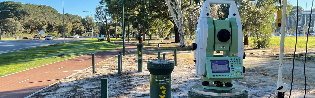
Under Regulation 20 of the Licensed Surveyors (General Surveying Practice) Regulations 1961, regular calibration of Electronic Distance Measurement Instruments (EDMI) is mandatory to ensure that measured distances are legally traceable to both national and international standards.
Landgate is accredited by the National Association of Testing Authorities (NATA) as a Verifying Authority for the verification of reference standards of length in Western Australia, and to enable EDMI calibration under the Regulation 20, Landgate maintains three EDM Baselines. Each EDM baseline consist of stable concrete pillars and is calibrated every two years (or as required) with certified distances (the standard) issued in accordance with Regulation 13 of the National Measurement Regulations 1999.
Certified distances, field procedures and calibration instructions are provided via Medjil.
EDM baseline locations:
- Curtin University, Kent St, Bentley, 24 hours 7 days a week
- Kalgoorlie Explosives Reserve, Piccadilly St, 7am to 3pm, Mon-Fri. Booking required.
- Busselton Bypass 24 hours 7 days a week
Booking sheets:
Barcoded staff calibration range
Landgate maintains a Barcoded Staff Calibration Range facility (the range) located on the Land Surveyors Licensing Board's examination site at Boya (Darlington). The range consists of two observing pillars and 21 evenly spaced stainless steel pins set in a granite outcrop. It is regularly monitored using calibrated invar staves to ensure its accuracy and stability.
Field calibration procedure, booking sheets, and technical manual are available via Medjil.
GNSS equipment testing facility
Landgate provides a Global Navigation Satellite Systems (GNSS) testing facility located at Curtin University. The facility consists of 4 pillars that are regularly monitored (horizontally and vertically) to ensure highest accuracy and stability.
Warning: Due to construction around Pillar 16, it should be avoided until further notice.
Landgate also provides this GNSS test network guideline to encourage a consistent approach to testing GNSS equipment.
The GNSS testing facility is available at Curtin University, Kent Street, Bentley, 24 hours, 7 days a week.